About us
Viet Nam’s Climate Risk Index – Data to understand climate risks and define trends for transformational adaptation measures and sustainable development
What is Viet Nam’s Climate Risk Index?
Viet Nam is ranked among those countries considered to be the most vulnerable to the effects of climate change. This vulnerability is shaped by the country’s geographic and socio-economic features, influenced by both Viet Nam’s long coastline and a large share of its population reliant on climate sensitive agricultural sectors, for income and food security. The coastline is particularly susceptible to floods, typhoons, and tropical cyclones, which are projected to intensify as a result of climate change. The Mekong and Red River Deltas are highly exposed to flooding, coastal inundations, as well as groundwater and soil salinization processes, which are driven through climate induced sea level rise. Other parts of the country, particularly the south-central coast, the central highlands, and northern mountainous regions, are vulnerable to extreme weather phenomena, such as droughts, landslides, flashfloods, and cold spells.
Climate change poses significant risks to Viet Nam, which creates an urgent need to monitor its potential consequences to economic and public sectors. Understanding future climate risks, including its long-term impacts, is becoming critical for decision makers and stakeholders to prevent their development progresses from experiencing damage or major losses.
As part of its commitments to the Paris Agreement and the National Strategy on Climate Change, Viet Nam is developing its National Adaptation Plan to proactively respond to anticipated climate risks and hazards. This data platform is designed to support policy makers, planners, research institutions, and academia with an up to date and comprehensive set of climate risk indexes. This can inform their sectoral planning and prioritization processes of adaptation measures for national and sub-national development agendas.
Viet Nam’s Climate Risk Index is an extensive open-source platform, providing geospatial analysis, indexes, and maps of climate risks. It is dynamic, and as such, it will be regularly updated with new analyses. It currently provides the consolidated findings of the most comprehensive risk and vulnerability assessments in Viet Nam. With maps covering all 712 districts of Viet Nam’s 63 provinces, it allows for a user-friendly visualization of the results, displaying key hotspots of vulnerabilities and major agricultural sectors at risk.
How does Viet Nam’s Climate Risk Index create change?
The website endeavors to synthesize the best available data onclimate vulnerable sectors, as well as provide a standardized index on various existing disaster hazards and projected climate scenarios at the district level, using the Viet Nam Climate Change Scenario (IMHEN, 2016). It aims to enhance transparency by utilizing scientific evidence-based risk assessments and to increase risk-informed planning by making the data publicly available. Our hope is that the platform will support inter-organisations data sharing and collaboration in their day-to-day planning, research, and development for new models and policy analysis of climate change impacts in Viet Nam.
Who uses Viet Nam’s Climate Risk Index?
It is designed to cover the primary needs of the national and provincial planning experts and policy development institutes in relevant ministries, whose development sectors are highly vulnerable to climate change and its associated risks. In order to systematically address climate risks, policy experts should have an understanding of the key trends of climate risks and how these may affect their specific sectors.
The platform can also be utilized by municipalities, researchers, civil society organizations, the private sector, and students, by providing an accessible data resource to undertake further studies and assessments.
Explore our datasets

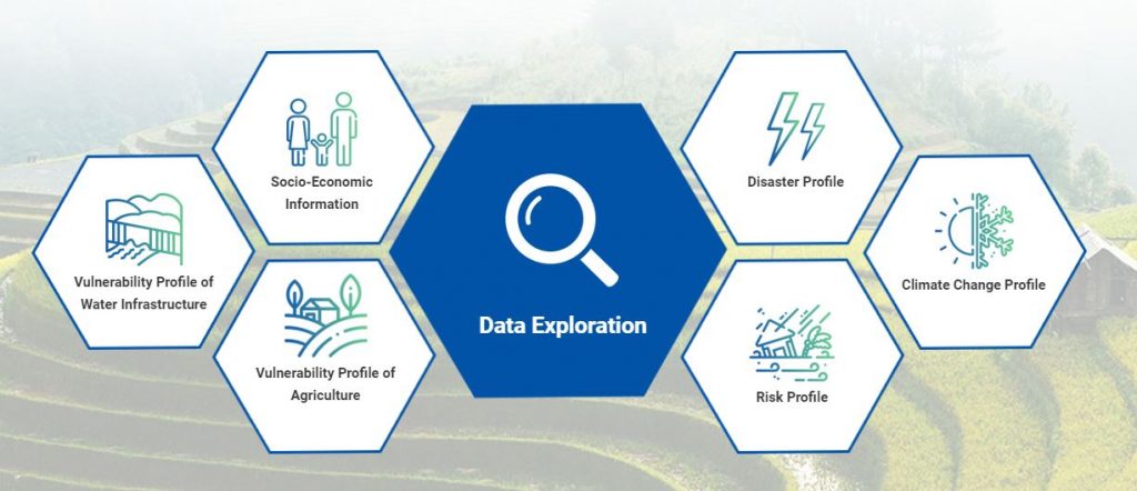
Socio-economic information: Geographic area, population, poverty levels, labour force (estimated by district)
Climate change profile: Sea level rise, projected changes in temperature and rainfall (estimated by district)
Past, current and projected major hazards: Storms, droughts, inundation due to super storms, coastal erosion in the Mekong Delta region (estimated by district)
Vulnerability index: Water resource infrastructures; Agriculture: including crops, livestock, aquaculture (estimated by district) – to be uploaded soon.
Risk index: Covering four types of water resource infrastructures, including both major hazards and climate change scenarios (estimated by district).
For further understanding about how the indexes were constructed, please visit our Library to refer to the Assessment Methodology and Technical Reports.
This platform was developed by joint projects between the United Nations Development Program (UNDP), the Ministry of Environment and Natural Resources (MONRE), and the Ministry of Agriculture and Rural Development (MARD). The projects are financed by UNDP, Global Environment Facility (GEF)/ SCCF and the BMU funded joint UNDP-FAO Nap-Ag Programme.


